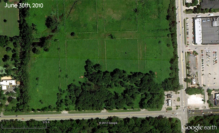
While working on a grant for restoration activity at Wolf Road Prairie earlier this year [Eliminate Phragmites Campaign!], I noticed a burn from this past spring was visible on Google Earth! Here is what the prairie normally looks like from above:

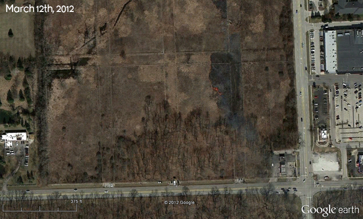
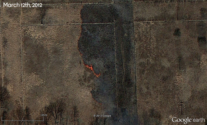
and here is the photo from March 12th of this year. The sidewalks built throughout the prairie when it was slated for development in the 1920s seem to make for good fire breaks. Here are some photos of the prairie shortly after it was burned.

Wolf Road Prairie is jointly owned by the Forest Preserve District of Cook County and the Illinois Department of Natural Resources, with restoration activities undertaken by a multitude of individuals and organizations, including the Salt Creek Greenway Association.
The tree whose shadow is visible in the upper left of this photo is the one in the background of the photo I posted back in July.

If you are ever near Westchester, IL (just west of Chicago), stop by this prairie in the late summer because it’s a beaut.